Monday, August 1, 2011

A circuit of Kinder from Hayfield

Yesterday the weather prospects look good, so I set out to experience a national park that I am not very familiar with: the Peak District.

Located  close to the centre of England, the Peak District is within easy reach of a number of conurbations - for me, a short drive down the motorway from Leeds.  It has a varied landscape caused by variation in the type of the underlying rock. The Dark Peak has a gritstone geology that features bleak moorland plateaux and lengthy edges of exposed gritstone. In the more southerly White Peak the dominant rock type is limestone, a permeable rock, which has produced a contrasting landscape with dry river valleys, caves and a 'Dales' feel.

I planned to walk a circular route that would take me up onto  Kinder Scout, a moorland plateau in the Dark Peak, and the highest point in the Peak District.

Snake Path sign, Hayfield
I parked in Hayfield, and left the village along the Snake path, which leads up onto the Kinder plateau. The path eventually leads to the Snake Inn,  which is located in the Woodlands valley, north of Kinder.
Looking down on Hayfield from the moors
 As I looked back down the path Hayfield lay beneath me in a wooded valley, surrounded by heather-covered uplands.
Sign on the Snake Path
I left enclosed farmland behind as the Snake Path took me up onto open moorland, where I came across this sign, dating from 1905, that warned against trespass. Kinder Scout has long been symbolic in the fight for the right for people to access open land.  In 1932 it was the site of a mass trespass, with walkers confronting game keepers about the right to be there. This action was a key part of the fight that led to a Government Act that enshrined in law free access to open land in England and Wales.
Kinder Resevoir
I followed the Snake Path up William Clough to the Kinder Plateau, passing Kinder Resevoir on the way.
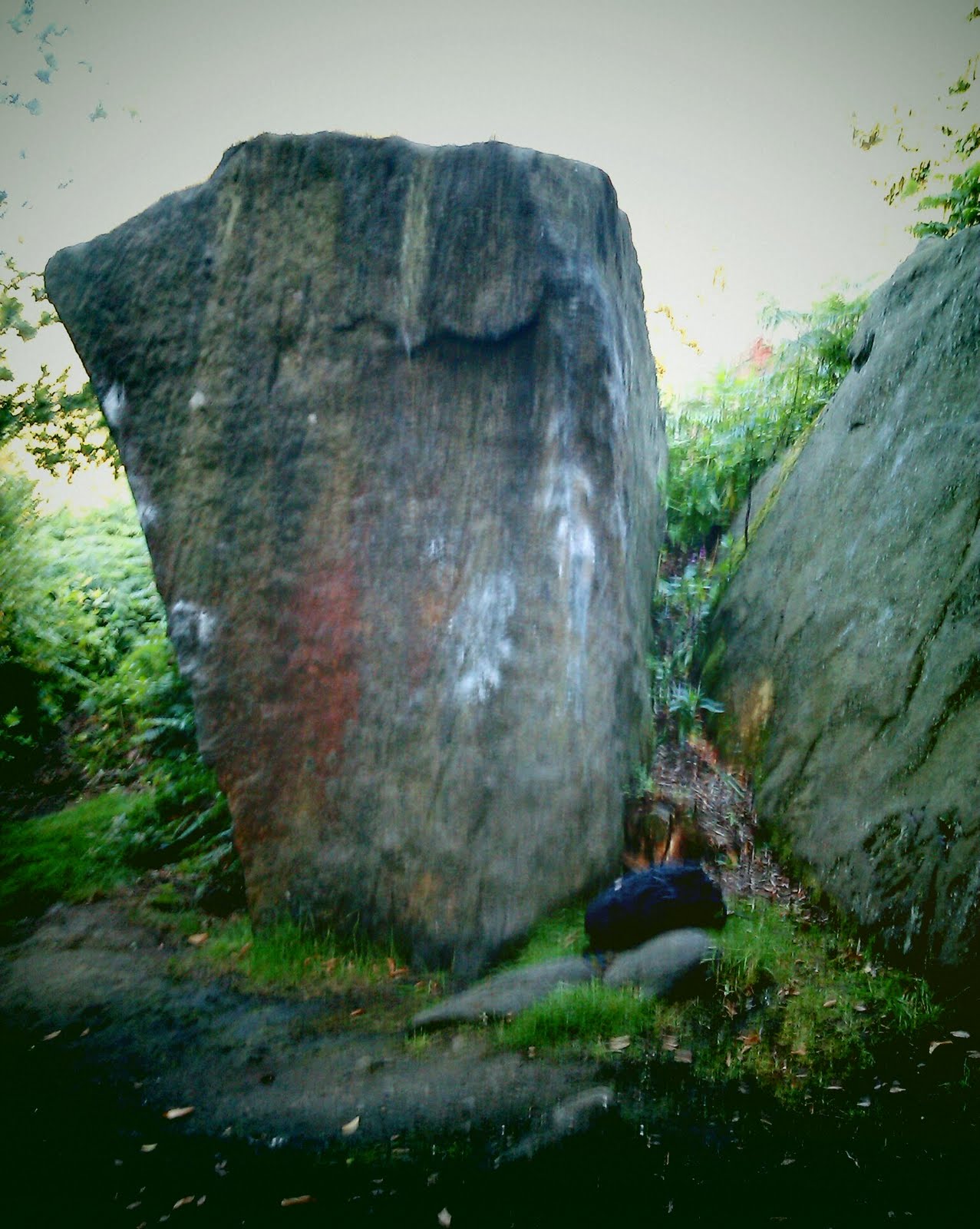
Sculpted gritstone boulders, Kinder plateau
At the top of William Clough, the Snake Path crossed the  Pennine Way, which I joined to go Southwards across the Kinder Plateau. I passed some large, sculpted, gritstone boulders. What had given them such flowing shapes - were they to high and exposed to be shaped by water flow? Could it have been the action of the wind?
Trig point, Kinder plateau
I left the pennine way to visit a trig point on an unnamed high spot. Getting there involved crossing open moorland and peat hags. The trig point stood on a rough concrete pedestal. Presumably when the trig point was built the concrete pedestal was actually a foundation laid within the peat. It appears that since construction the peat has been eroded away, leaving the foundation standing proud from the remaining sandy subsoil. Was this erosion caused by the action of thousands of feet, or by the elements?
A dry Kinder Downfall
I rejoined the Pennine Way and continued southwards to Kinder Downfall. Lying in the centre of a bowl of dark gritsone cliffs, this is where the Kinder river descends from the plateau over a series of gritstone ledges.  It was only a mid-summer trickle, but would be more dramatic when the river is in spate, or perhaps frozen.
Pennine way heading looking to Kinder Downfall
I continued southwards along the Pennine way, which follows the western edge of the Kinder plateau for several kilometres. This was a well trodden path with a solid rock base; quite a different experience to negotiating numerous peat hags on the open moorland.
Eroded landscape of Kinder Low
I reached another trig point, on the (named) summit Kinder Low. This time I was sure that the peat had been stripped back to the underlying sand by thousands of feet. Although this was a summit, it didn't feel like it because the ground curved away from the high point so gently, giving the allusion that I was standing on a plain. Where was the feeling of exposure and height, of excitement and achievement? At this point naming the area the Peak District (and, indeed, calling Kinder Scout area the 'high peak'), seemed like false advertising.
Kinderlow End
I descended via the spur of Kinderlow End towards Hayfield (shown above), feeling slightly underwhelmed by the Dark Peak experience. Would I be back? I'm not sure. Perhaps the area is more exciting under less favourable conditions; a bit of fog, perhaps a bit of snow. Or maybe gritstone, which makes the Dark Peak such a good location for rock climbing, produces a landscape that is to bleak for exciting, varied, walks?


Tuesday, July 19, 2011

Places to climb in North Wales when the weather is dodgy (I) - the Dinorwig slate quarry

North Wales has a huge variety of locations and different rock types to climb; from sea cliff to mountain crag; from slate, to limestone, to rhyolite.

Wind, rain, and changing weather conditions can make it difficult to find good climbing on any given day. I find this especially frustrating on short visits when I want to make the most of limited time.

When the conditions are unsettled (intermittent rain, damp, but not torrential downpours across the whole region, when the best option is to stay indoors, or go to the zoo!), I have found that the range of locations and rock types in the region mean that it is often possible to find somewhere in good condition for climbing, and somewhere I won't feel out of my depth if weather conditions change suddenly.

Australia, Dinorwig
The Dinorwig quarry is a huge old slate workings in the hillside near Llanberis. Slate was quarried here for over a hundred years, although production ceased in the middle of the last century. Parts of the quarry are now used for hydroelectricity generation, and it has had occasional film roles when a forboding location was needed.

From the main road into Llanberis the quarry look dark and menacing, but up close it is more inviting.  It is warm and sheltered, the rock is clean and solid, and plants have gained a foothold, bringing the place to life. There is also a lot of rusting industrial equipment, some tunnels, and derelict buildings that add to the atmosphere and highlight the human origins of the place.

The Sidings area, Dinorwig
I took the above photo one morning after a rainy night - many climbers had come to the quarry to take advantage of the conditions there. Slate dries quickly, there is minimal seepage, and some aspects of the quarries are in the sun for most of the day. Combined with the facts that the quarry is terraced, which provides a series of broad ledges and short single pitch routes, and many routes are a short walk from the car park or bus stop, this a great climbing location after a rainy spell. If the rain comes back, I can quickly get back to the car, head into Llanberis, drink tea, and wait for the rain to stop.

There are lots of the routes in the quarry, from low grade sport climbs to hard trad routes, providing something for everyone. Many of the routes, including some of the trad routes, are bolt protected, so it possible to make a quick dash into the quarry, and out again if needed, carrying a minimal rack.


Monday, July 4, 2011

Horse Chestnut trees and their insect guests

This is a leaf from a horse chestnut (conker) tree. Although native to Southern Europe the species is common in the UK, especially in parks and hedgerows, where they provide children with an easy source of conkers each autumn.

The patches on the leaf are cavities caused by the leaf mining moth Cameraria ohridella. Moth larvae live in the cavities between the outer layers of the leaf, where they feed on sap in the leaf veins. By late summer the majority of horse chestnut leaves will be brown, making it look like autumn has arrived early, at least for horse chestnuts. If you come across a horse chestnut tree in your local park or hedgerow, it will probably been infested with leaf miner, and the patches will be visible from some distance away! The adult moth, which is free-flying, is relatively a non-discript stripy brown colour, much less noticable than the leaf mines.

The moth started spreading from its original home in Macedonia in 1989, and is now widespread throughout Europe. It reached the UK in 2002.  Now it is rare to find a horse chestnut in the UK whose leaves are not curling and brown from leaf miner damage by the end of the summer. The health of infested trees is not affected (although they do tend to produce smaller conkers), which is good news - other invasive tree infestations, such as the fungus that causes Dutch Elm disease, have changed the landscape of the UK,  and because horse chestnuts are big trees that often found in prominent locations, the loss of this species would change the landscape substantially.

Lots of other plants are affected by leaf miners, which are easy to spot by looking for swirling blistered/discoloured patches on leaves.


Wednesday, June 29, 2011

Caley bouldering

It was a beautiful evening; sunny, clear, but still cool and with a slight breeze. These are good conditions for bouldering, where the aim is to climb short 'problems' on cliffs and boulders, using a crash mat to land on when you fall. 20 minutes north of Leeds, outside the town of Otley, is  Caley - a popular bouldering venue that has lots of problems described in guidebooks. After finishing work I headed to Caley for the evening.
Oak tree, Caley
Caley is a wooded hillside that has gritstone boulders and small cliffs scattered across it. In the woods there were foxgloves and bilberries covering the ground (along with the ubiquitous bracken), and the trees were predominantly birch and oak, with a few other species mixed in. Some of the oaks, like the one in this photo, had the space to grow broad, spreading canopies that give an ancient woodland feel.
Flapjack boulder, Caley
Among the trees I found my first boulder. It was The Flapjack, which was a good boulder to get started on; it had some easy problems - in the font 3+-5+ range, and it was not very high, so I would not fall far. Judging by the chalk marks, plenty of people have had the same idea.
Cream eggs boulders, Caley
Next, The Cream Eggs. This is a pair of steeper boulders with smooth sides and sharp corners that provide some challenging problems. I repeatedly fell off the chalky corner that has my bag underneath in the photo above, eventually admitting defeat. The corner has a grade of font 6a+.
The Chicken Run boulder, Caley
 Breaking from the snack theme, this boulder is The Chicken Run. It had some short, fun problems that I finished the evening on.The problem that goes up the corner of The Chicken Run is one of the few easier problems at Caley that has been given a name - it is called Cold Turkey - and has a grade of font 5+.
Almscliff
Nursing sore fingers and ready for dinner, I set off home. I emerged from the woodland to blue skies and views across the valley. The small hill on horizon is Almscliff, a famous Yorkshire climbing and bouldering venue.

Sunday, June 26, 2011

The North York Moors: Goathland, Falling Foss and Fylingdales

To celebrate mid-summer I visited the North York Moors. The North York Moors are a national park in the north east corner of Yorkshire; primarily a heathery, upland plateau, the park extends to the North Sea coast around Whitby. Much of the park is open access land,  where one has the freedom to wander away from paths and rights of way.

I arrived in the village of Goathland early in the morning, having driven over the mist-covered moors from Leeds, with the intention of following a route over moorland to the East and South of Goathland.

Goathland Station
I started my walk from the station in Goathland. It is part of the North Yorkshire Moors Railway, which is a heritage steam railway that runs north-south through the moors. The station recreates railway stations from decades ago, but it was still early so there were no trains to complete the picture.

Moor above Goathland
My route took me North Eastwards across Goathland Moor. This was my first experience of the heather-covered plateau. The lack of trees and deep greens and browns of the heather gave the moor a bleak, gloomy feel. The morning mist was clearing, however, and there was even a patch of blue sky - things were looking up!

Cross-leaved heather in flower
I found some early-flowering heather in a sheltered spot. The bright purple clusters contrasted with the dark foliage. It will be worth coming back later in the summer, when the majority of the heather is in flower, to see the moor blanketed purple. The heather was a mix of Calluna and Erica species, which occur in such abundance because the moor is managed to provide good habitat for red grouse that need young heather shoots to feed on and older heather to hide in.

Red grouse are regarded as the prince of gamebirds and people pay a lot of money to shoot them, making an important contribution to the local economy. It is an awkward bird to manage though - it suffers from predators, and especially parasites, which can severely affect grouse numbers. Also, birds cannot be reared in captivity then released to augment wild populations. End result: huge expanses of heather moorland that are carefully managed for grouse production across Northern England, Scotland and Wales.

Old-fashioned pylon
I crossed a road and continued east across the moor. The major vertical features on the moor were a line of pylons heading north to Whitby. The pylons were an old, elegant design, with patches of rust emphasising their age.

North York Moors dry stone wall
Moorland was separated from lower level farmland by a dry stone wall. I followed it southwards to a bridleway that led across the farmland.

Young cattle
The farmland was used for grazing. In one field nervous young cows followed me as I passed.

Dog rose
As I crossed the farmland there were dog roses flowering in the hedgerows, along with plenty of honeysuckle. I could smell both species from some distance away!

Falling Foss
The bridleway entered a wooded valley, which led to Falling Foss. Although the stream feeding the falls was small, it went over a long drop, and with the sunlight making the water sparkle it was a dramatic sight. I stopped at the tea room by the falls and the meagre change I had left over from paying the parking fee in Goathland was just enough for tea and cake.

Lone pine tree on the moorland
Much refreshed, I walked Southwards upstream until the woods became thinner, and after a short climb I was back on moorland. A lone tree stood sentry - it is probably an escapee from a nearby Forestry Commission plantation, which I intended to skirt around next.

Felled plantation
It was a mature plantation and some areas had been felled. Dark, featureless plantation does not look good, but the felled land looked worse. The Forestry Commission is more enlightened these days, so hopefully they will replant with some attractive and ecologically interesting native species.

Cotton grass, growing in a hollow
After a couple of miles of walking Southwards across moorland I came across a patch of cotton grass in a dip. The tufts at the top of each stem were windblown.

Louven Howe
Looking across the North York Moors
Continuing South, I reached the high point of the moor - Louven Howe. Great views all around, especially as the weather had continued to improve. The view in one direction was dominated by RAF Fylingdales, whose land I would pass through next...

Fylingdales warning sign
RAF Fylingdales is a ballistic missile warning station - it has a big radar array that rises pyramid-like from the moor, which is visible for miles around. During the Cold War the base was responsible for spotting missiles that would have initiated a '4 minute warning' had the Soviets launched a nuclear attack. Now it is part of the U.S.A missile defence shield. As such they are a bit touchy about security - there are signs up outlining what you can and can't do, which included taking photos of the base from controlled land that I was on. The sign above, however, is apparently a fraud, and after a moments pause I dismissed it and carried on my way.

It was interesting to see that close to the base, where I guess there hasn't been grazing and heather management for grouse, scrub and small trees were starting to cover the moorland. Left long enough without human intervention, presumably the whole moor would go the same way.

Rail bridge, North York Moors Railway
After a couple of miles stomping through heather, I reached the main road over the moor. This was the same road I had used to drive to Goathland in the morning, when it had been shrouded in mist . I had to follow the road for a mile, and it was busy, so I was frequently jumping onto the verge as traffic passed in both directions. Eventually the road brought me to the North York Moors Railway line, which I passed under, and then I followed a bridleway back into Goathland.

Sheep grazing the lawn, Goathland
The biggest disappointment about Goathland? Plenty of sheep, but no goats. Mis-selling was a theme of the village - a few of the shops had signs such as 'Grocer' and 'General Store', which I went into to try and buy a drink, only to find shelves of souvenirs but no groceries.

Tuesday, April 5, 2011

Haytor and Low Man - climbing Dartmoor granite

I met with up Will with the intention of climbing a few routes on Haytor and Low Man, two tors on the Eastern edge of Dartmoor, a few miles outside Bovey Tracey. Will has recently taken up climbing, and was ready to start leading; the range of single pitch routes up the tors, on solid Dartmoor granite, were ideal for him.
Beautiful weather, easy access, and good low-grade routes meant that there were plenty of climbers on Haytor by the time we arrived (having driven from Oxford, via Bristol).
I led Bulging Wall, a Very Difficult grade route up the middle of Haytor south face. Will followed me up with ease, getting his first taste of climbing on granite, and we looked back over the edge to mass of climbing gear below - this was not the place for contemplative climbing!
Will felt ready for his first lead, so he took my gear and set off up Zig Zag, a Difficult grade route to the left of Bulging Wall. In no time we were both at the top. Will was happy to sit and revel in his conquest, looking out over Dartmoor.
From the top of Zig Zag, we looked across to Low Man. The west face - which has the majority of the routes - was hidden, so we wandered over to inspect it; time for something harder? Up close the face looked inviting, and I eventually persuaded Will to try and second Raven Wing, a VS 4b route that follows a prominent arete. Early on there was a nice step out onto the arete that placed me over a void, followed by straightforward climbing. The granite here had more edges than that of Haytor, something I enjoyed, and I got so absorbed in climbing that I forgot to take any close up photos of Low Man. Will attempted to follow me up, but it was too much at the end of a long day, so he lowered off and a friendly climber seconded the route.
Exhausted, elated, challenged, but content, we set off into the sunset in search of food and somewhere to sleep.

Tuesday, March 8, 2011

A perfect, sunny, lost day? Cycling from Witney, through North Leigh, to Kidlington

I cycled to work today, along country roads that run between Witney and Kidlington, in West Oxfordshire. The conditions were perfect; dry, cloudless, still, with little traffic to disturb the peace. In the sun, it was warm enough to feel like spring. Following what seemed like weeks of overcast skies and rain, I welcomed the change.

Frosty West Oxfordshire fields
The sun rose into a perfect sky. There was frost on the ground because the temperature had dropped below zero the night before.

North Leigh church
My route took me past the church in the village of North Leigh. Cotswold stone buildings, like this church, fit perfectly into the landscape when sunlight brings out the warm tones of the stone.


Tree in bud
The trees, dark and twisted without their leaves, reached up towards the sun. Their buds hinted at a re-awakening after winter.

I got ready to carry on to work. How many days can there be that are so perfect? Can I afford to waste them? I continued my journey towards a day confined to a windowless office.